Planning and Policy Library
Seattle Parks & Rec will begin a comprehensive revision of our Parks and Open Space Plan (POSP) in spring 2026! This plan will inform SPR’s approach to park development, access, improvement, and maintenance carried out between the years of 2028 to 2034. The last POSP was adopted in 2024 and is required for regulatory and funding purposes to be updated every six years.
For more information please visit: https://engageseattleparks.com/posp-update
ADA: Serving Patrons with Disabilities
In accordance with the requirements of Title II of the American Disabilities Act of 1990, Seattle Parks and Recreation has a policy of non-discrimination against persons with disabilities in its programs, services, and activities. For more information, visit our ADA page where you can download forms and view policy documents.
You may also contact our ADA Coordinator via email: Kyle Bywater, or call (206) 684-7548 with ADA questions.(TTY) (206) 233-1509
Mailing address:
ADA Coordinator
Seattle Parks and Recreation
4554 NE 41st St.
Seattle, Washington 98105
Bicycle Use Policy and Multi-Use Trail Policy
Seattle's multi-use trails are paved shared-use paths that allow for multiple users including bicycles, pedestrians, and others. The new Multi-Use Trail Policy, and updated Bicycle Use Policy, create regulatory consistency with other trail owners such as Seattle Department of Transportation and the University of Washington, following the passage of a new Washington State law in 2018. The new policies allow for the use of electric-assist personal mobility devices - such as e-bikes, e-scooters, e-skateboard, and electric unicycles - that fit the definition of Class 1 and Class 2 e-assist bicycles. Such devices must have electric motors no more powerful than 750 watts, and have e-assist limitations up to 20 mph. In addition, a new 15 miles per hour speed limit is in effect for all users on Multi-Use Trails managed by Seattle Parks and Recreation.
Boundaries and Encroachments
Are you a neighbor of City park land? City park lands include developed parks, playgrounds and trails, undeveloped greenspaces, and streets that have been designated as park boulevards. These park lands are Seattle's natural treasures and home to many native species of plants, birds and animals. To help preserve and protect these valuable areas, the Seattle Department of Parks and Recreation wants to work with neighbors and others who enjoy our parks to clarify boundaries and promote the proper use of park lands.
Where are the boundaries?
Boundaries along park lands, especially undeveloped areas and boulevards, are often difficult to locate exactly. Many park areas have not been surveyed or are not clearly marked on the ground. Existing fences or landmarks may not be reliable. Lines determined from plat maps, utility lines, roadways, or various commercially produced maps may not be accurate. Don't just "eyeball" it.
What is an encroachment?
Encroachment is the unlawful, unauthorized, or unpermitted use of the property of another. An encroachment is often thought of as a structure, such as a fence or part of a building, but an unauthorized use, such as parking, a storage area or garden, may also be considered an encroachment.Encroachments on public land often include:
- buildings or structures, such as garages, sheds, fences, playhouses or tree houses, swing sets or other play equipment;
- private-use areas, such as parking spaces, patios, gardens, play or sport areas;
- storage areas for belongings, such as boats, RV's, firewood, gardening equipment;
- "stuff you usually keep out of sight", such as trash cans, compost bins, yard waste piles, junk cars, dumping of other debris or litter;
- privately installed landscaping, such as hedges or borders that "claim" public property or limit the public's use or enjoyment of it.
There is no adverse possession of public property, which means private owners cannot establish rights to City land by using it for a number of years. The Department may issue permits which allow very limited, temporary non-park use of park lands. To obtain an application form, please contact us at (206) 233-7935 or email parkproperty@seattle.gov.
What about driveway access along park boulevards?
Property owners living adjacent to park boulevards often have rights of access, even if not explicitly defined in land ownership documents. Contact us with questions about individual access.
What's wrong with dumping yard waste?
Lawn clippings and yard waste may seem harmless, but piles of this kind of waste can kill everything they cover including tree roots. They may also present a fire hazard, attract rodents, or contribute to the instability of slopes. Yard waste can be composted, used as mulch, or disposed of through the City's "clean green" yard waste collection program or at City transfer sites. For information, please call Seattle Solid Waste Utility at 684-3000.
Are there restrictions on tree cutting or pruning?
Cutting, pruning or trimming of trees or plants on park property is not allowed. Trees are an invaluable asset to the beauty and health of our park system. Untrained "topping" or "chopping" to improve a view, or for any other reason, can permanently damage or kill a tree. In areas where trees are mature and reaching the end of their lifespan, the Department works with community groups to develop and implement reforestation projects. For more information please call the department's Green Seattle Program at (206) 615-1046. If you have questions about tree safety, please call the Department's Arborist at (206) 386-1688.
Is it OK to clear out low vegetation from park lands?
Generally, NO. Trees, shrubs, and plant life in our park system not only contribute to a neighborhood's beauty and character, but they also provide unseen benefits such as runoff buffering, slope stabilization and habitat for wildlife. "Cleaning up" the undergrowth disturbs the protective ground layer which is essential to a healthy forest and may destroy shelter and food sources for native birds and small animals. The natural habitat can be enhanced by planting desired native trees and shrubs and managing the existing vegetation. The Department works with volunteers through the Adopt-A-Park program to eliminate noxious weeds, such as non-native blackberry and ivy, and re-establish native plants on park lands. To help in this effort, call 684-4075 for information on Adopt-A-Park.You can contact the Washington Department of Fish and Wildlife at (360) 902-2515 for more information on landscaping for wildlife habitat.
What can you do to be a good neighbor?
Maintaining and enhancing the natural beauty of our park lands is a BIG JOB. If you would like to volunteer your time and talent to help, please call 684-4075 for information about the Adopt-A-Park program.
Questions? Contact:
Property and Acquisition Services
(206) 233-7935
parkproperty@seattle.gov
City of Seattle Legislative Department SPR Recreation Division Evaluation
Seattle Parks and Recreation (SPR) provides recreation opportunities that help Seattle residents of allages and backgrounds, and with all manner of interests, relax, stay healthy, and learn new skills. This study is intended to describe how SPR's Recreation Division operates, evaluate SPR's performance, andrecommend opportunities for improvement. This evaluation is in support of providing enhancedaccountability for voters following the creation of the Seattle Park District in 2014. The evaluation was conducted through a financial and document review, staff and stakeholder engagement, and acomparison of SPR to peer recreation service providers. Read the full study here. For a summary of recommendations, please see this document.
Citywide Skatepark Plan
The Citywide Skatepark Plan, created in 2007, identifies a network of safe, legal places throughout Seattle for people of all ages, races and sexes to enjoy. It also offers recommendations intended to change the way people think about and experience skateboarding. For history about our skateparks and projects, download the Citywide Skatepark Plan from our archives.
Golf Master Plan
Download the full plan
The City of Seattle operates four golf facilities with a total of three 18‐hole courses, three 9‐hole shortcourses, two driving ranges, and one putting course (mini‐golf). Four clubhouses are also operated to provide food and beverage service, merchandise sales, and general support at each of the courses. While the courses continue to be popular with local golfers and economically sustainable for the City, many of the clubhouses, maintenance facilities, restrooms, and other support facilities have reached the end of their useful life and are in need of upgrade or replacement. Missing elements such as driving ranges and banquet facilities also impact the golf experience at some locations and prevent the golf program from reaching its full revenue generating potential.
Horticulture
The Horticulture Program has a long history in Seattle Parks and Recreation. Its heritage goes back to the beginning of 20th century when the Park Commission invited the Olmsted Brothers to plan and design the framework for the park system for the City of Seattle.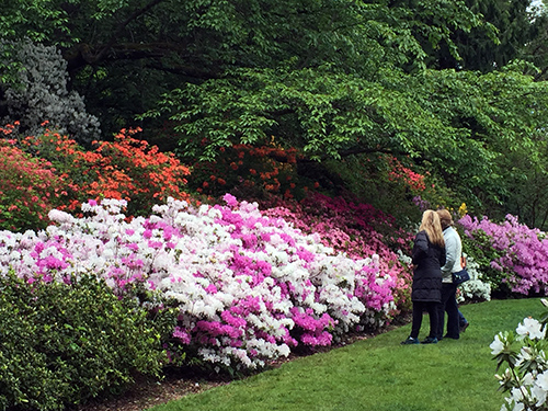
At present, within the 2,300 acres of developed landscapes in Seattle Parks, there are more than 280 acres of Specialty Gardens, 240 acres of plant beds and more than 1,800 acres of turf area. There is a wide variety of horticulture programs and magnificent floral displays within developed parks, and in the Japanese Garden, Kubota Garden, Washington Park Arboretum, Volunteer Park Conservatory, and Woodland Park Rose Garden.The Department has its own greenhouse and nursery facilities where more than 180,000 annuals and perennials, woody ornamentals and native plants grown each year. The Department has also undertaken a number of horticultural and landscape renovation projects, trail improvement and maintenance projects, and urban reforestation program (GSP) that have successfully restored natural ecosystems.From the very cultural to the very natural, we have horticultural programs to meet everyone's taste.
Gardens
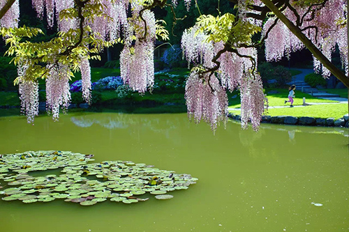
Seattle Parks and Recreation's Specialty Gardens are some of Seattle's most beautiful and inspiring places. In addition to beauty and comfort, these gardens also provide education and conservation opportunities. They are the sparkling jewels within the Seattle Parks system.
- Seattle Japanese Garden
- Kubota Garden
- Volunteer Park Conservatory
- Washington Park Arboretum
- Woodland Park Rose Garden
- Woodland Park Zoo
Seattle Parks also have unique, historical designed landscapes and small gardens that are popular with the community. They offer respite from the city's noise, quiet places to sit and reflect, and a riot of color and fragrance in the spring.
The gardens and horticultural parks display diverse and unique collections of plants, landscape features, and culture heritages. They reflect the human effort to create a harmonious blend of nature and art.
Landscape Restoration Program
Landscape plantings have a life span, and because our park system is over 125 years old, the Department has an ongoing program for landscape renovation and or restoration. The goal of this program is building an ongoing landscape system with sustainability and functionality in mind. The quality, safety and beauty of park landscape assets are restored so that these will be used by the current generation and be carried and maintained healthy and ecologically for next generation. This program also allows the Department to reevaluate landscape areas to determine if redesign is needed in addition to restoration. It's also an opportunity to upgrade infrastructure such as irrigation and drainage systems.The Landscape Restoration program focuses on removal, improvement, and renovation of developed landscapes in parks, at community centers, pools, and other park facilities. Specific Areas of Landscape Improvement:
- Invasive removal
- Structural pruning of ornamental specimen trees and large shrubs
- Tree and shrub suitability assessment and replacement
- Low maintenance and/or water wise plant selection and landscape installation
- Design native or ornamental planting
- Control common weeds and invasive plants
- Site grading and drainage solutions
- Irrigation upgrade and adjustment
- Erosion control
- Path construction
- Stairway and wall construction
- Trail renovation and restoration
- Shoreline (lake, pond, & waterfront) embankment restoration and erosion control
- Urban wildlife and pollinator habitat restoration
Propagation and Production Program
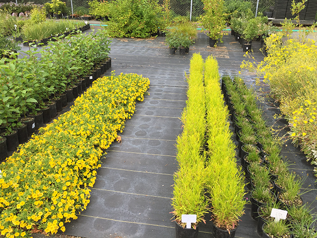
Seattle Parks and Recreation has a propagation facility at Jefferson Greenhouse, to produce plants that are utilized in Parks and other city landscapes. Jefferson Greenhouse gardeners grow 100,000 to 120,000 annuals and perennials, plus an additional 75,000 woody natives and ornamentals every year. We provide these plants for the Department's Park resources and natural areas through Green Seattle Partnership and citywide Landscape renovation programs and trail program.
Integrated Pest Management
Current Actions
In August 2019, Mayor Jenny Durkan signed an executive order placing the pesticide glyphosate in the most restricted category under the City's IPM program, following increasing evidence that it is a probable carcinogen. In addition, she directed all land management departments to participate in an IPM interdepartmental team, which would update the City's IPM plan by the end of 2019, including the list of approved pesticides. Learn more about the City's IPM program and the executive order
While most plants and wildlife co-exist peacefully within Seattle's parks and open spaces, these urban habitats also include non-native pest species which negatively impact native species. Pests can be insects, plant diseases, invasive weeds, animals or birds. They disrupt the natural ecology of a habitat and landscape, creating an unhealthy environment for plants and sometimes for humans and pets. Since the late 1970s Seattle Parks and Recreation has used a process called Integrated Pest Management (IPM) to maintain healthy landscapes. IPM is a comprehensive strategy which prioritizes preventative non-chemical methods to reduce pests such as thoughtful plant selection, using mulch to reduce weeds and build soil health, and hand weeding and other non-chemical techniques. In IPM, pesticides are used sparingly as a last resort in targeted applications by trained professionals.
History of IPM
In 1999, the City of Seattle implemented a Pesticide Reduction Strategy to eliminate the use of the most potentially hazardous herbicides and insecticides, and to achieve a 30 percent reduction in overall pesticide use. Starting in 2001, Seattle Parks and Recreation began maintaining 22 pesticide-free parks (~50 acres), and currently maintains over 250 areas - including playgrounds, picnic shelters, community gardens, and turf fields - without pesticides. In 2015 Seattle became a "Bee City, U.S.A.," institutionalizing the commitment to collaborate with the community on establishing and maintaining healthy pollinator habitats within Seattle.
IPM at Seattle Parks and Recreation
Seattle Parks manages over 6,400 acres of parks and open space, nearly 12% of the city's land. These public spaces provide recreation opportunities for people and habitat for a variety of urban wildlife.
IPM has been practiced by SPR for over 40 years and is our standard operating procedure in natural areas, neighborhood parks, specialty gardens, golf courses, and greenhouses. An IPM program begins with park design and continued attention to plant care and culture, as healthy plants resist pests. If a pest concern is identified, SPR staff use cultural, mechanical, biological and (if needed) chemical control methods. For example, cultural could mean planting the right plant in the right place, mechanical might mean hand-weeding, biological could be insect predators or bacterial products for mosquito control, and chemical might be a synthetic or naturally derived herbicide.An IPM program considers the anticipation of potential pest problems to be the most important tool in pest management. Staff are trained and knowledgeable landscape maintenance professionals who understand the plants cultural needs and the potential for pest impacts and monitor landscape assets continuously in their daily work. Each park facility is unique, and staff evaluate their IPM strategies the over time and make adjustments as needed for long-term successful pest management.
Horticultural and grounds maintenance staff share responsibility for managing pest problems. Staff who apply pesticides are required to have a Washington State Public Pesticide Operator's license and attend continuing education classes in IPM on an annual basis to update their skills and knowledge in pest management.
The department also employs an IPM Coordinator who monitors overall programs, and insures that regulatory requirements are met, including tracking pesticide use. This coordinator works with staff to research and develop new pest management strategies, especially regarding alternatives to pesticide use. The Coordinator also sits on the City of Seattle's Interdepartmental IPM committee, which reviews programs annually and makes adjustments to procedures and protocols.
Pesticide-Free Parks
SPR maintains 22 parks without the use of pesticides:
- Alki Playground
- Baker Park on Crown Hill
- Beer Sheva Park
- Belvoir Place
- Benefit Playground
- Bradner Gardens Park
- Day Street Park
- Denny Blaine Lake Park
- Elliot Bay Bikeway
- Fairmount Playfield
- Lake City Mini Park
- Lake Union Park
- Lakewood Playground
- Magnolia Tidelands Park
- Mayfair Park
- Meridian Playground
- West Montlake Park
- Northgate Community Center and Park
- Regrade Park (Belltown Off-Leash Area)
- TT Minor Playground
- University Playground
- Webster Playground
Sustainable Landscapes Programs
Bridget Kelsh
Bridget.Kelsh@seattle.gov
Irrigation and Water Usage
We're always working to conserve our natural resources and preserve our watershed. Please report any leaks or other water issues you see in Seattle parks to the Parks Jobline at (206) 684-7250 or e-mail PKS_Work_Order_Desk@seattle.gov.
Here's what we're doing at Parks:
- Inspecting and repairing our irrigation systems.
- Implementing parts of our water shortage plan, which enables us to use much less water while protecting our valuable landscape assets.
- Suspend new landscape installations until the shortage is lifted or rain is enough for new plants.
- Discontinue washing City vehicles.
- Giving careful consideration to, and preparing to make changes in, how we use water for our wading pool program, our irrigation systems, and cleaning hard surfaces, should the shortage get worse.
- Following these tips from Seattle Public Utilities on how to use water wisely; we hope you'll follow them at home too.
- Put shutoff valves on outdoor hoses, and use them!
- Don't leave water running in sinks when you don't need it.
- Use water diffusers on sink faucets.
- Wash only full loads of clothes.
- Fix leaking toilets and faucets.
Water Shortage Contingency Plan
This plan provides guidelines for a systematic response, should the need arise, to reduce demand in the event of a water supply disruption or weather related water shortage.
- Seattle Parks and Recreation Water Shortage Contingency Plan
- Plans for Newly Established or Planned Landscapes
Seattle Public Utilities Water Shortage Contingency Plan:
Between the Seattle School District No. 1 and Seattle Parks and Recreation
All public facilities and grounds, either owned by the City or District, shall benefit and be used by Seattle children, adults, and families to the maximum extent possible. The District and City have mutual interests in helping young people learn and develop recreation skills and in providing opportunities for people of all ages to participate in recreation activities. It is incumbent upon the District and Parks to develop a unified approach to serving the community's recreation needs and to cooperatively maintain City and District facilities and grounds in order to foster community and neighborhood learning and vitality.
2022-2027 Joint Use Agreement.between Seattle Parks & Recreation and Seattle Public Schools.
Non-Parks Use of Parks Land Policy
If you need or want to use park property for a non-park use, you must obtain permission from the Department of Parks and Recreation, usually in the form of a Revocable Use Permit. Find out how to get a permit for non-park use of park land
"Permits for Non-Park Use of Park Property" includes any private use of park land or park open space that limits or diminishes the public's ability to use or enjoy park land, even temporarily. This would include activities such as making repairs or changes to your property, installing or replacing utility lines, storing belongings on park property, and adding or removing landscaping. View the Policy for Non-Park Uses of Park Property
Park lands include parks, playgrounds, viewpoints, boulevards, and other land under control of the Department of Parks and Recreation. If you are not sure, please check with the Department before proceeding. Contact the Department's Property Management office at (206) 233-7935. Permits are revocable upon thirty (30) days notice or immediately upon failure of the Permittee to comply with the terms and conditions of the Permit. Unauthorized use of park property, including failure to apply for and obtain a Revocable Use Permit, is unlawful and subject to enforcement actions or other remedies as specified in Seattle Municipal Code 18.30.
Park Naming Policy
Criteria the Parks Naming Committee considers in naming parks include: geographical location, historical or cultural significance, and natural or geological features. A park may be named for a person no longer living (deceased a minimum of three years) who made a significant contribution to parks and/or recreation. The Park Naming Committee, created by Ordinance 99911, consists of the Superintendent of Parks and Recreation, the Chair of the Board of Park Commissioners, and the Chair of the city Council committee that considers parks and recreation issues, or their designated representatives. Download the full policy
The Parks Code is Chapter 18.12 of the Seattle Municipal Code (SMC). It includes, in a single chapter, all City ordinances pertaining specifically to parks and park property. You can find the Parks Code on the City Clerk's web site. It is updated quarterly. Also visit our Rules and Regulations page for clarification on common questions.
Pickleball Pilot Study Report
The sport of pickleball has made strides in popularity since its conception in 1965. To accommodate this growth, Seattle Parks and Recreation (SPR) hosts approximately 5,000 hours of indoor pickleball play each year in its community center gyms. In 2017, SPR expanded opportunity for pickleball play outdoors through a pilot program that added pickleball lines to existing tennis courts for a total of 26 new courts and expanded free access to nets, paddles, and balls. The overwhelming response to this pilot program was positive and many of the new courts are well-used. Download the full pilot study report here.
Guided by the 2019 Pilot Study, SPR did additional outreach to direct investments for outdoor pickleball. The 2021 -2022 Outdoor Pickleball Study informs the department’s direction for developing new opportunities to play pickleball in the park system. Download the summary report here. Please visit this page for pickleball updates.
Please direct any comments on the reports to: pickleball@seattle.gov.
Pollinator Habitat
Part of Seattle Parks and Recreation's commitment to sustainable land management is to support the many pollinators that live in or near our 6,400-acre system of parks. Many native insects and birds, such as hummingbirds, butterflies and bees, depend upon certain flowers blossoming throughout the year, and also require other habitat elements for survival such as woody debris and water sources. These pollinators need this healthy habitat in connected corridors or expansive ecosystems during critical times of the year.
Seattle is a "Bee City USA," which means that we have made a commitment to support native bees in how we manage our land. SPR's Integrated Pest Management program ensures we do not use pesticides that can harm bees and other native species and also provide the habitat elements needed through the use of wood chip mulch, large woody debris and installation of native plants. Additional support comes in the form of our Native Plant Policy and the various Vegetation Management Plans that guide park care.Pollinators are crucial to the health of our urban ecosystems and to a local food system. Native bees such as mason bees are highly productive, able to pollinate 95% of the flowers they visit compared to 5% for the non-native honeybees. These pollinators are helpful for native plants, as well as the abundant ornamental flowers in parks and yards, and the many vegetables and fruit trees in our orchards.
Meadows in Parks
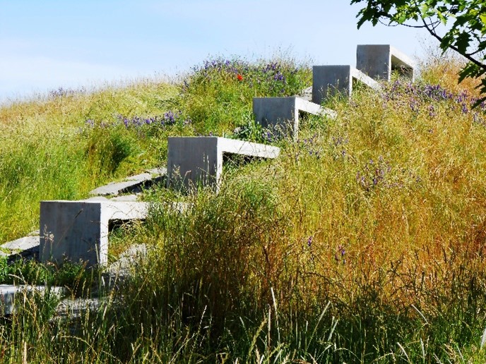
Seattle Parks and Recreation has designated at least six areas as meadow habitat throughout the city. These open habitats are managed to reduce invasive woody plants and support species that rely on these ecosystems. Wildflowers, grasses, and small shrubs provide the food and shelter that animals such as songbirds, Garter snakes, butterflies, and bees need. Meadows are mowed every one to three years to control invasive plants such as Scotch Broom and Himalayan Blackberry, but otherwise left to grow naturally. You can find these meadows in Genesee Park, Discovery Park, Bitter Lake Park, Hubbard Homestead Park, Mineral Springs Park, and Lake Washington Boulevard.
Pollinator Gardens
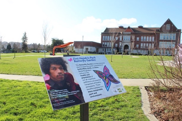
Many parks in Seattle have designated pollinator gardens to create habitat to support these insects. The gardens make for beautiful landscapes and learning opportunities. By integrating these intentional habitats, SPR is able to create a web of natural areas where pollinators can thrive throughout the city. Look for gardens at locations such as Jimi Hendrix Park and Bradner Gardens. New Pollinator Corridors are also in development, starting with parks along Seattle's rebuilt waterfront and beyond in partnership with the Port of Seattle, Seattle Art Museum, and Expedia Group.
Meadows on the Margins

Many areas in parks receive little active use and are mainly enjoyed for their aesthetic aspects. Following a shift in resources away from mowing during the COVID-19 pandemic, SPR realized many of these "passive turf" areas that grew to their natural height were a real boon for wildlife and enjoyed by many residents. In 2021, SPR is allowing some areas that would normally be mowed to grow longer and provide the same benefits of our larger meadows. Longer grass holds on to water longer (good for our summer drought), absorbs more carbon dioxide (helps with our climate goals), saves staff resources (good for the budget). Look for "This is Pollinator Habitat" signs or areas with longer grass to see where we are creating new meadow habitat.
Public Involvement Policy
Public Involvement Policy for Parks Planning Processes and for Proposals to Acquire Property, Initiate Funded Capital Projects, or Make Changes to a Park or Facility
Adopted July 1, 1999
Amended October 1, 2002
Amended August 30, 2006
Amended July 31, 2012
The purpose of this policy is to describe the role of park users and neighbors in park planning processes, and in review processes for funded capital projects and other proposals that have the potential to change the look or use of a park or facility. It describes the planning processes that become the assemblage of needed projects for which Parks applies for funding. It lays out circumstances in which Parks does not seek public input. It calls for a description of what factors have impacts on a given decision, how professional Parks staff incorporate, or do not incorporate, suggestions from the public in their recommendations, and identifies information to be presented to the Board of Park Commissioners. Download the full policy.
Recreation Demand Study
In 2015-2016 a consultant hired by Seattle Parks and Recreation conducted a demand study focused on 7 areas of recreation: community centers, athletic fields, senior programs, programs for people with disabilities, environmental learning, teen programs and off-leash areas. The study combined data from diary studies, surveys and an assessment of level of service standards. Current demand was assessed and projections were made based on estimated future growth in Seattle. Download the Recreation Demand Study
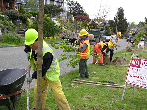
Seattle Parks and Recreation Department's Tree Maintenance Program maintains the health and safety of trees through out the City's park system. Along with the Urban Forest Restoration Program, the Department has devoted resources to help maintain our urban forest canopy. Tree Crews maintain trees inside the City's parks and along its boulevards; respond to citizen inquires regarding trees along park boundaries; conduct hazard tree reviews from staff and citizen reports; and answer a significant number of tree health and care questions from the general public. For more information about our policies around plants, trees, gardens, and park lands, visit our Horticulture Program page.
Tree Management Policy
The purpose of the tree management policy is to maintain, preserve, and enhance the urban forest within parks. In 2022, Seattle Parks and Recreation updated the policy to be consistent with current practices and to incorporate climate change and equity considerations.
Vegetation Management Plans
Vegetation Management Plans are written to guide the growth, development, and maintenance of parks and open spaces. Each Vegetation Management Plan is designed to bring together the diverse interests at work (and at play) in a park or open space, and inform and direct the actions of the organizations and individuals that manage it. Contact us with questions or to request specific plans for parks or greenspaces.